
Radar satellites allow researchers to pinpoint where sinkholes are happening
New research shows that with special radar satellite technology, it’s possible to detect warning signs and pinpoint exact locations where sinkhole activity is happening.
FIU geophysics professor Shimon Wdowinski and his former postdoctoral research fellow Talib Oliver-Cabrera collaborated with a team from University of South Florida — including Sarah Kruse and Tonian Robinson — to inspect several areas throughout densely populated West-Central Florida’s “Sinkhole Alley.”
The team used special radar technology and analysis tools to detect changes in the land and identify the exact areas where land subsidence — a common effect of sinkholes — is occurring. They found land subsidence is happening at rates of up to a quarter inch a year at various sites in Hernando and Pasco counties.
"Our research shows that with special radar satellite technology, we can monitor large areas for localized subsidence and provide highly valuable warning information that could protect people and their property,” Wdowinski said.
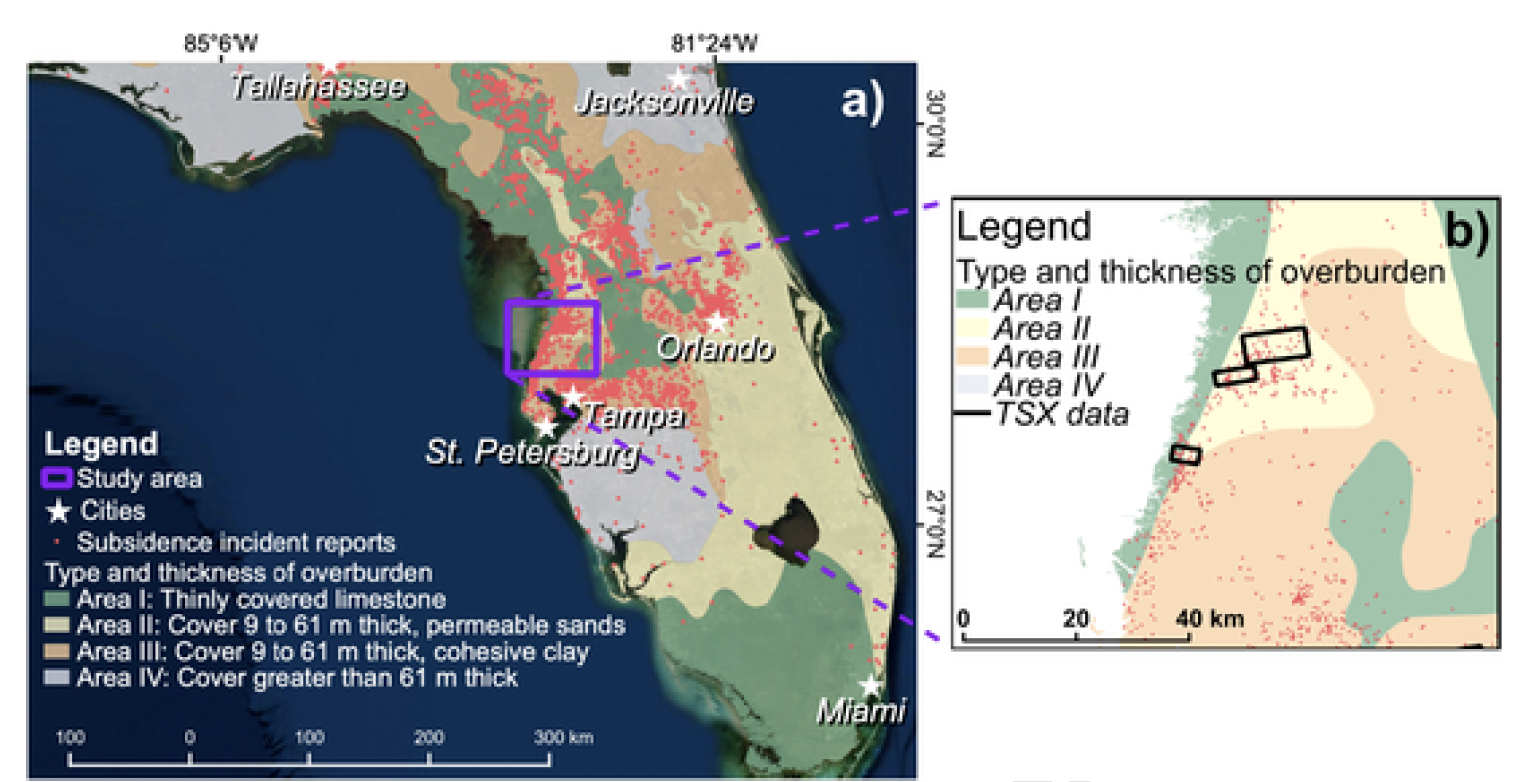
Map show sinkhole distribution in Florida
Sinkholes are so common in Florida because porous limestone lies below the ground. Rainwater penetrates the soil and dissolves the rocks. When the water causes too many cavities and holes, the soil cover layer move downward into the holes and the ground subsides — and in some cases, it can cave in.
There are different triggers that can make a sinkhole collapse. When it happens, though, it causes major social and economic effects to people, homes, businesses, roads and other infrastructure.
As the study’s authors point out, detecting sinkholes is a tremendous challenge. Sinkholes form over underground cavities that can only be detected with geophysical surveys or by drilling into the ground.
Land subsidence — one of the most important clues to sinkhole presence — also cannot be seen by the human eye. But, it can be seen with the help of InSAR — Interferometric Synthetic Aperture Radar. This special radar technology allows researchers to detect very small changes on Earth’s surface. In fact, over time, changes can be detected with millimeter-per-year accuracy.
Once the radar satellite detected ground movements, the team used ground-based technologies, such as ground-penetrating radar, to look for any evidence of sand or soil flowing into cavities in the ground that could later collapse.
These findings also have important and lifesaving implications for Florida, as well as other areas around the world that face the threat of sinkholes.
“While we tested the method only in Hernando and Pasco counties, it would also work in Hillsborough and Pinellas Counties, and anywhere else with similar construction and vegetation patterns,” Kruse said.
The research was supported by grants from the National Science Foundation. The results were recently published in Remote Sensing of Environment.
An expert in space geodesy, natural hazards and sea-level rise, Wdowinski is part of the FIU Institute of Environment and the Department of Earth and Environment. He has conducted research on land subsidence in other parts of the world, including Miami Beach, Mexico City and Norfolk, Va.